About 30 members met by the Victoria Hotel where there is an excellent view over the bay. Here, Pete Rawson pointed out the main geological features, in particular drawing attention to the curvature of the scars that were beginning to appear as the tide was receding. The curvature picks out beautifully the structure of the Robin Hood’s Bay dome, the core of which lies some distance offshore. The rocks at shore level in the bay belong to the Lower Jurassic Redcar Mudstone Formation while in the cliffs to the left (north) of the viewpoint the sediments pass upward into the Staithes Sandstone Formation. To the south, in the far distance, we could see The Peak at Ravenscar, where the Peak Fault marks the western margin of a shallow rift, the Peak Trough.
We then walked down to the shore and headed southward over the scars as far as Boggle Hole. Here members examined several of the scars to see why they form such prominent features. It was soon recognised that each scar forms a coarsening upward cycle; the lower, vertical face is usually a silty mudstone and this grades up into a fine sandstone which forms the upper face and top surface of the scar. The sandstones in particular are strongly bioturbated (burrowed) and some excellent trace fossils were seen, especially the U-shaped crustacean burrows called Rhizocorallium. One mudrock surface exhibited small pyritised ammonite nuclei.
From Boggle Hole we walked back towards Baytown, examining the rocks en route. Members were asked to look for a change in the topography of the shore and eventually, just beyond the slipway and opposite the protective sea-wall we noted that the scars had vanished and the whole inter-tidal zone was almost flat. Here the rocks are essentially mudstones alone. The leader explained that the change from a cyclic to non-cyclic sequence is the local reflection of a global rise in sea-level, marking the beginning of the Pliensbachian age. The same lithological change can be seen in Wine Haven, the most southerly embayment of Robin Hood’s Bay, where the internationally recognised Global Stratotype Section and Point (GSSP) for the base of the Pliensbachian Stage is recognised.
On approaching the cliffs just north of the sea wall, where they swing round towards the north-east, we saw good exposures of the mudstones on the rocky platform. Here they include very thin (a few cm thick), nodular, red-weathering ironstone bands. Fossils are common in the mudstones, particularly Pinna, a large, flattened, fan-shaped bivalve. In life, these shells stood upwards with one end buried in the sediment. Other burrowing bivalves were seen in life position and occasional small pyritised ammonite nuclei were also found.
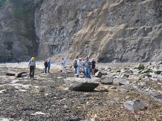
In this area there is a particular danger of falling rocks so we worked well away from the foot of the cliff. But some of the fallen blocks of Staithes Sandstone from the upper part of the cliff could be examined safely and showed a varied bivalve fauna, especially scallops (Pseudopecten and Oxytoma).
After a vote of thanks to the leader the party then returned to the village.