8th July - Leaders: Simon Chapman and Steve Livera
This was a joint meeting with CMHS (Cleveland Mining Heritage Society) and SAHS (Scarborough Archaeological and Historical Society). It was led by Simon Chapman and Steve Livera.
The party met in the Sandsend seafront car park (GR NZ 861129) and walked across the foreshore and scar toward Sandsend Ness. Steve Livera described the stratigraphic succession exposed in the cliff face and in the overlying alum works. The vantage point provides an excellent view of the Toarcian Whitby Mudstone Formation succession comprising mudstones of the Mulgrave Shale and Alum Shale Members including the distinctive Bituminous Shale and Ovatum Band.
The stratigraphic scene having been set, Simon Chapman then gave an account of the extractive industries (alum and cement) that worked these rocks from the seventeenth century until about 1867. He pointed out culvert tunnels in the cliffs that were part of a transport system bringing alum liquor from the steeping pits above Sandsend Ness to Alum Works at the location where the car park is today.
The party returned to the Sandsend car park and up the steps at its northern end which lead to the disused railway track that now forms part of the Cleveland Way. Continuing along the railway path the liquor tunnels were observed closer at hand by those members of the party brave enough to peer over the cliff edge. The party continued along to Sandsend Ness Quarry. Here the Dogger and Saltwick Formations can be seen overlying the upper beds of the Alum Shale. Calcareous nodules in the latter were quarried for cement in the eighteenth century. Simon described the various remains of the alum workings in the quarry and gave a brief history of the Whitby, Redcar and Middlesbrough Union Railway.
After lunch on the seafront at Sandsend, the party headed into Mulgrave Woods. Simon pointed out the old kiln used to fire the limestone to make Roman Cement and the building which housed the mill used to grind the product just inside the estate grounds. The mill was originally a corn mill. The mill and kiln ceased cement production in 1932 or 1933.
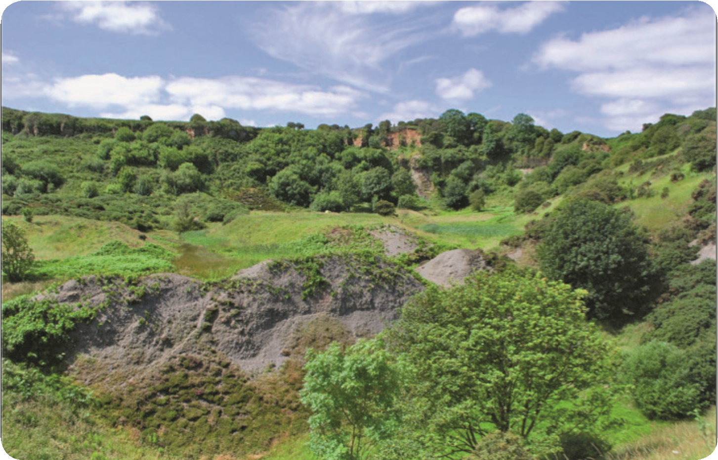
Walking up into the estate the party then visited the sites of the old alum quarries which were amongst the first to exploit the mineral in the area in the seventeenth century, before the business moved to the coastal quarries seen before lunch. The Asholme quarry site was very overgrown and it was tricky to pick out clear details but the calcining and spoil tips were seen and there was discussion about how the sites were designed to have wind breaks for the calcining process. Wet patches probably marked the sites of steeping pits. At the back of the main quarry about half of the group climbed through thick vegetation to find the entrances to the mines that were used to extract cementstones from just below the Dogger Formation. A network of adits have been surveyed by Dave Richardson who showed that rock was mined to an adit length of 140m into the back of the quarry. The Dogger Formation is over 2m thick here but very heavily weathered.
The party climbed up to view the Old Mulgrave Castle and Chris Hall outlined part of its history, including the Humphrey Repton garden, now completely neglected and overgrown. The walk out on the north side of the valley went past the Sandsend Quarry which is now fully overgrown.