9th September
The trip was led by Liam Herringshaw (Hull University) and Jonny Imber (Durham University). The party met at Stoupe Bank Farm car park (GR NZ 958034) and took the footpath down to the beach. The trip had two major objectives, (i) to inspect the sedimentology and stratigraphy of the Redcar Mudstone exposed on the scar between Stoupe Beck Sands and Wine Haven, and (ii) to examine the Peak Fault exposed in the cliffs below Ravenscar and the foreshore at Peak Steel.
The Lower Jurassic strata at Robin’s Hoods Bay are defined by an arcuate series of prominent reefs formed by more resistant beds. These dip uniformly inland such that the bay forms half of a truncated anticline, the eastern flank and the crest of the dome are submerged in the bay beneath sea level.
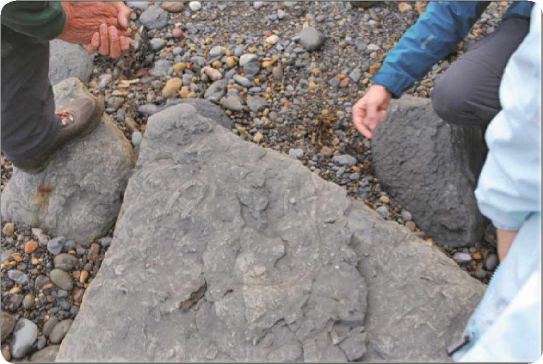
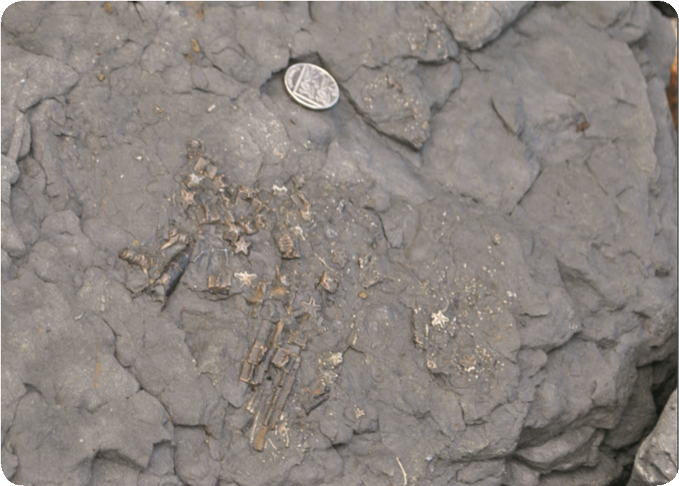
The dip of the section from Stoupe Beck to Wine Haven swings from the southwest to the south and as the party traversed the foreshore it moved up section through the Siliceous and Pyritous Shales (Sinemurian and Lower Pliensbachian) units of the Redcar Mudstone Formation. Liam Herringshaw described the depositional setting of this part of the section which comprises multiple cycles of alternating mudstones and coarser calcareous siltstones and finegrained sandstones (which form the resistant reefs). The coarse-grained beds, which typically have sharp bases, sometimes with erosional scours, are interpreted as have been deposited by storm generated waves and contain reworked nearshore sands and shell fragments. The intervening mudstones represent the background sedimentation between storm surges. The coarsegrained deposits contain a rich and varied assemblage of trace fossils with excellently preserved examples of Rhizocorallium and Thalassinoides. A few ammonite specimens and numerous belemnites were found in the mudstones.
After lunch, the party visited the Global Stratotype Section and Point (GSSP) for the base of the Pliensbachian stage of the Early Jurassic which is located at Wine Haven. Pete Rawson and Liam Herringshaw described the purpose and processes involved in the selection of GSSPs. These horizons are designated by the International Commission on Stratigraphy and provide a global reference for the base of stages in the geological time scale. They are normally defined by palaeontological changes, usually the first appearance of a particular fossil species. The chosen outcrop should be in a section of continuous deposition with no hiatuses and free from tectonic or sedimentary movement. The Base Pliensbachian GSSP is taken at the first appearance of the ammonite Bifericeras donovani and the genus Apoderoceras. This occurs at the base of Bed 73b that lies immediately above a distinctive double row of siderite nodules found towards the base of the Pyritous Shales.
Having spent some time discussing the merits of the GSSP site the party continued to walk south-eastwards to Peak Steel to look at the Peak Fault. The Peak Fault is one of the most impressive faults exposed along the Yorkshire Coast. Seismic data acquired offshore of Robin Hood’s Bay show the fault is the westerly bounding fault of a narrow graben (or trough) that extended northwards towards Whitby. Jonny Imber and Steve Livera described the expression of the fault in cliff section below the Ravenscar golf course and at Peak Steel. The latter is formed by a wedge of Staithes Sandstone preserved between the Peak Fault and a minor splay to the west. It can only be inspected in detail at when the Steel is exposed at low tide. Here the Staithes Sandstone is shattered by a dense network of joints and fractures some of which fan out from bends, or kink points, in the main fault. At the end of the steel the joints are so extensive that the Staithes Sandstone is fragmented into numerous rhombic columns. Analysis of the geometry of the joint planes should provide a lot of information about the stress regimes associated with movement of the peak fault.
After visiting Peak Steel the party split into two. As the tide was coming in some members returned to Stoupe Beck via the foreshore. The remainder spent some time examining the fault in the cliff section before climbing the footpath back up to Ravenscar.
The two faults that bound Peak Steel coalesce near the base of the cliff so that only a single fault can be seen in the cliff face. At the base, mudstones of the Redcar Mudstone Formation in the footwall juxtapose against mudstones of the Whitby Mudstone Formation (Bituminous Shales) in the hanging wall. The lithological similarity of these formations makes interpretation of the fault throw difficult (i.e. mudstone against mudstone) and it can only be resolved by the careful identification of distinctive beds of concretions in each formation.
During the climb to Ravenscar the party stopped to examine the juxtaposition of strata higher up the fault plane and to review the sense of movement and timing of the Peak Fault. A vantage point a few metres below the exit onto the golf course provides an excellent view of the both sides of the fault where Lower Jurassic Staithes Sandstone juxtaposes sandstones of the Middle Jurassic Dogger and Saltwick Formations. Steve Livera described the different stratigraphy either side of the fault and evidence that the fault was active in the Early and Middle Jurassic.